(800) 829-4933
(800) 829-4933 IRS search EIN
(800) 829-4933
(800) 829-4933
Case No.: CV0229-12 Castro.Camacho
HACKETT, CLIFFORD, CAMACHO, MARCEL, CASTRO, LEANN ~ Temporary Restraining Order
Case Type: Civil


country latitude longitude name
AD 42.546245 1.601554 Andorra
AE 23.424076 53.847818 United Arab Emirates
AF 33.93911 67.709953 Afghanistan
AG 17.060816 -61.796428 Antigua and Barbuda
AI 18.220554 -63.068615 Anguilla
AL 41.153332 20.168331 Albania
AM 40.069099 45.038189 Armenia
AN 12.226079 -69.060087 Netherlands Antilles
AO -11.202692 17.873887 Angola
AQ -75.250973 -0.071389 Antarctica
AR -38.416097 -63.616672 Argentina
AS -14.270972 -170.132217 American Samoa
AT 47.516231 14.550072 Austria
AU -25.274398 133.775136 Australia
AW 12.52111 -69.968338 Aruba
AZ 40.143105 47.576927 Azerbaijan
BA 43.915886 17.679076 Bosnia and Herzegovina
BB 13.193887 -59.543198 Barbados
BD 23.684994 90.356331 Bangladesh
BE 50.503887 4.469936 Belgium
BF 12.238333 -1.561593 Burkina Faso
BG 42.733883 25.48583 Bulgaria
BH 25.930414 50.637772 Bahrain
BI -3.373056 29.918886 Burundi
BJ 9.30769 2.315834 Benin
BM 32.321384 -64.75737 Bermuda
BN 4.535277 114.727669 Brunei
BO -16.290154 -63.588653 Bolivia
BR -14.235004 -51.92528 Brazil
BS 25.03428 -77.39628 Bahamas
BT 27.514162 90.433601 Bhutan
BV -54.423199 3.413194 Bouvet Island
BW -22.328474 24.684866 Botswana
BY 53.709807 27.953389 Belarus
BZ 17.189877 -88.49765 Belize
CA 56.130366 -106.346771 Canada
CC -12.164165 96.870956 Cocos [Keeling] Islands
CD -4.038333 21.758664 Congo [DRC]
CF 6.611111 20.939444 Central African Republic
CG -0.228021 15.827659 Congo [Republic]
CH 46.818188 8.227512 Switzerland
CI 7.539989 -5.54708 Côte d’Ivoire
CK -21.236736 -159.777671 Cook Islands
CL -35.675147 -71.542969 Chile
CM 7.369722 12.354722 Cameroon
CN 35.86166 104.195397 China
CO 4.570868 -74.297333 Colombia
CR 9.748917 -83.753428 Costa Rica
CU 21.521757 -77.781167 Cuba
CV 16.002082 -24.013197 Cape Verde
CX -10.447525 105.690449 Christmas Island
CY 35.126413 33.429859 Cyprus
CZ 49.817492 15.472962 Czech Republic
DE 51.165691 10.451526 Germany
DJ 11.825138 42.590275 Djibouti
DK 56.26392 9.501785 Denmark
DM 15.414999 -61.370976 Dominica
DO 18.735693 -70.162651 Dominican Republic
DZ 28.033886 1.659626 Algeria
EC -1.831239 -78.183406 Ecuador
EE 58.595272 25.013607 Estonia
EG 26.820553 30.802498 Egypt
EH 24.215527 -12.885834 Western Sahara
ER 15.179384 39.782334 Eritrea
ES 40.463667 -3.74922 Spain
ET 9.145 40.489673 Ethiopia
FI 61.92411 25.748151 Finland
FJ -16.578193 179.414413 Fiji
FK -51.796253 -59.523613 Falkland Islands [Islas Malvinas]
FM 7.425554 150.550812 Micronesia
FO 61.892635 -6.911806 Faroe Islands
FR 46.227638 2.213749 France
GA -0.803689 11.609444 Gabon
GB 55.378051 -3.435973 United Kingdom
GD 12.262776 -61.604171 Grenada
GE 42.315407 43.356892 Georgia
GF 3.933889 -53.125782 French Guiana
GG 49.465691 -2.585278 Guernsey
GH 7.946527 -1.023194 Ghana
GI 36.137741 -5.345374 Gibraltar
GL 71.706936 -42.604303 Greenland
GM 13.443182 -15.310139 Gambia
GN 9.945587 -9.696645 Guinea
GP 16.995971 -62.067641 Guadeloupe
GQ 1.650801 10.267895 Equatorial Guinea
GR 39.074208 21.824312 Greece
GS -54.429579 -36.587909 South Georgia and the South Sandwich Islands
GT 15.783471 -90.230759 Guatemala
GU 13.444304 144.793731 Guam
GW 11.803749 -15.180413 Guinea-Bissau
GY 4.860416 -58.93018 Guyana
GZ 31.354676 34.308825 Gaza Strip
HK 22.396428 114.109497 Hong Kong
HM -53.08181 73.504158 Heard Island and McDonald Islands
HN 15.199999 -86.241905 Honduras
HR 45.1 15.2 Croatia
HT 18.971187 -72.285215 Haiti
HU 47.162494 19.503304 Hungary
ID -0.789275 113.921327 Indonesia
IE 53.41291 -8.24389 Ireland
IL 31.046051 34.851612 Israel
IM 54.236107 -4.548056 Isle of Man
IN 20.593684 78.96288 India
IO -6.343194 71.876519 British Indian Ocean Territory
IQ 33.223191 43.679291 Iraq
IR 32.427908 53.688046 Iran
IS 64.963051 -19.020835 Iceland
IT 41.87194 12.56738 Italy
JE 49.214439 -2.13125 Jersey
JM 18.109581 -77.297508 Jamaica
JO 30.585164 36.238414 Jordan
JP 36.204824 138.252924 Japan
KE -0.023559 37.906193 Kenya
KG 41.20438 74.766098 Kyrgyzstan
KH 12.565679 104.990963 Cambodia
KI -3.370417 -168.734039 Kiribati
KM -11.875001 43.872219 Comoros
KN 17.357822 -62.782998 Saint Kitts and Nevis
KP 40.339852 127.510093 North Korea
KR 35.907757 127.766922 South Korea
KW 29.31166 47.481766 Kuwait
KY 19.513469 -80.566956 Cayman Islands
KZ 48.019573 66.923684 Kazakhstan
LA 19.85627 102.495496 Laos
LB 33.854721 35.862285 Lebanon
LC 13.909444 -60.978893 Saint Lucia
LI 47.166 9.555373 Liechtenstein
LK 7.873054 80.771797 Sri Lanka
LR 6.428055 -9.429499 Liberia
LS -29.609988 28.233608 Lesotho
LT 55.169438 23.881275 Lithuania
LU 49.815273 6.129583 Luxembourg
LV 56.879635 24.603189 Latvia
LY 26.3351 17.228331 Libya
MA 31.791702 -7.09262 Morocco
MC 43.750298 7.412841 Monaco
MD 47.411631 28.369885 Moldova
ME 42.708678 19.37439 Montenegro
MG -18.766947 46.869107 Madagascar
MH 7.131474 171.184478 Marshall Islands
MK 41.608635 21.745275 Macedonia [FYROM]
ML 17.570692 -3.996166 Mali
MM 21.913965 95.956223 Myanmar [Burma]
MN 46.862496 103.846656 Mongolia
MO 22.198745 113.543873 Macau
MP 17.33083 145.38469 Northern Mariana Islands
MQ 14.641528 -61.024174 Martinique
MR 21.00789 -10.940835 Mauritania
MS 16.742498 -62.187366 Montserrat
MT 35.937496 14.375416 Malta
MU -20.348404 57.552152 Mauritius
MV 3.202778 73.22068 Maldives
MW -13.254308 34.301525 Malawi
MX 23.634501 -102.552784 Mexico
MY 4.210484 101.975766 Malaysia
MZ -18.665695 35.529562 Mozambique
NA -22.95764 18.49041 Namibia
NC -20.904305 165.618042 New Caledonia
NE 17.607789 8.081666 Niger
NF -29.040835 167.954712 Norfolk Island
NG 9.081999 8.675277 Nigeria
NI 12.865416 -85.207229 Nicaragua
NL 52.132633 5.291266 Netherlands
NO 60.472024 8.468946 Norway
NP 28.394857 84.124008 Nepal
NR -0.522778 166.931503 Nauru
NU -19.054445 -169.867233 Niue
NZ -40.900557 174.885971 New Zealand
OM 21.512583 55.923255 Oman
PA 8.537981 -80.782127 Panama
PE -9.189967 -75.015152 Peru
PF -17.679742 -149.406843 French Polynesia
PG -6.314993 143.95555 Papua New Guinea
PH 12.879721 121.774017 Philippines
PK 30.375321 69.345116 Pakistan
PL 51.919438 19.145136 Poland
PM 46.941936 -56.27111 Saint Pierre and Miquelon
PN -24.703615 -127.439308 Pitcairn Islands
PR 18.220833 -66.590149 Puerto Rico
PS 31.952162 35.233154 Palestinian Territories
PT 39.399872 -8.224454 Portugal
PW 7.51498 134.58252 Palau
PY -23.442503 -58.443832 Paraguay
QA 25.354826 51.183884 Qatar
RE -21.115141 55.536384 Réunion
RO 45.943161 24.96676 Romania
RS 44.016521 21.005859 Serbia
RU 61.52401 105.318756 Russia
RW -1.940278 29.873888 Rwanda
SA 23.885942 45.079162 Saudi Arabia
SB -9.64571 160.156194 Solomon Islands
SC -4.679574 55.491977 Seychelles
SD 12.862807 30.217636 Sudan
SE 60.128161 18.643501 Sweden
SG 1.352083 103.819836 Singapore
SH -24.143474 -10.030696 Saint Helena
SI 46.151241 14.995463 Slovenia
SJ 77.553604 23.670272 Svalbard and Jan Mayen
SK 48.669026 19.699024 Slovakia
SL 8.460555 -11.779889 Sierra Leone
SM 43.94236 12.457777 San Marino
SN 14.497401 -14.452362 Senegal
SO 5.152149 46.199616 Somalia
SR 3.919305 -56.027783 Suriname
ST 0.18636 6.613081 São Tomé and Príncipe
SV 13.794185 -88.89653 El Salvador
SY 34.802075 38.996815 Syria
SZ -26.522503 31.465866 Swaziland
TC 21.694025 -71.797928 Turks and Caicos Islands
TD 15.454166 18.732207 Chad
TF -49.280366 69.348557 French Southern Territories
TG 8.619543 0.824782 Togo
TH 15.870032 100.992541 Thailand
TJ 38.861034 71.276093 Tajikistan
TK -8.967363 -171.855881 Tokelau
TL -8.874217 125.727539 Timor-Leste
TM 38.969719 59.556278 Turkmenistan
TN 33.886917 9.537499 Tunisia
TO -21.178986 -175.198242 Tonga
TR 38.963745 35.243322 Turkey
TT 10.691803 -61.222503 Trinidad and Tobago
TV -7.109535 177.64933 Tuvalu
TW 23.69781 120.960515 Taiwan
TZ -6.369028 34.888822 Tanzania
UA 48.379433 31.16558 Ukraine
UG 1.373333 32.290275 Uganda
UM U.S. Minor Outlying Islands
US 37.09024 -95.712891 United States
UY -32.522779 -55.765835 Uruguay
UZ 41.377491 64.585262 Uzbekistan
VA 41.902916 12.453389 Vatican City
VC 12.984305 -61.287228 Saint Vincent and the Grenadines
VE 6.42375 -66.58973 Venezuela
VG 18.420695 -64.639968 British Virgin Islands
VI 18.335765 -64.896335 U.S. Virgin Islands
VN 14.058324 108.277199 Vietnam
VU -15.376706 166.959158 Vanuatu
WF -13.768752 -177.156097 Wallis and Futuna
WS -13.759029 -172.104629 Samoa
XK 42.602636 20.902977 Kosovo
YE 15.552727 48.516388 Yemen
YT -12.8275 45.166244 Mayotte
ZA -30.559482 22.937506 South Africa
ZM -13.133897 27.849332 Zambia
ZW -19.015438 29.154857 Zimbabwe
…
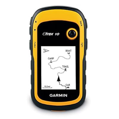
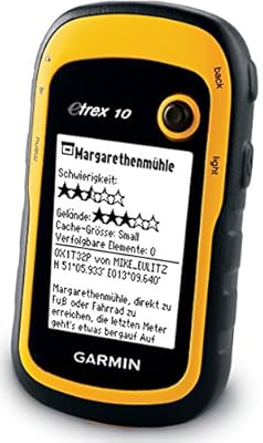
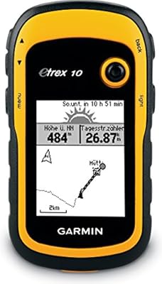
Garmin eTrex 10 Worldwide Handheld GPS Navigator

To pinpoint your position on a map of the world you need to work out your co-ordinates, known as latitude and longitude. Latitude is your position north or south of the Equator. Lines, or parallels, are drawn around the Earth at intervals. The North Pole is assigned the latitude 90º north and the South Pole latitude 90º south.
Lines of longitude, or meridians, are drawn a little differently. The line of longitude corresponding to 0º, which passes through Greenwich in London, is called the Prime (or Greenwich) Meridian. Longitude lines run along the Earth’s surface in a north–south direction, and unlike latitude lines, they divide the globe into segments like those of an orange, rather than regular strips.

HOW TO MEASURE LATITUDE
It’s possible to measure latitude by comparing your position on Earth with the position of either the sun or the North Star (Polaris). Measurements using the sun are possible on a clear day in the northern or southern hemispheres, when the sun is easy to find. However, measurement of latitude isn’t as straightforward as you might think. Accurate readings can only be taken at noon, when the sun is at its highest in the sky. To complicate matters further, the sun rises higher in summer than in winter, and this must be allowed for in any calculation.
Being so far away and only one of a myriad stars visible to the naked eye, the North Star isn’t as easy to find as the sun. Furthermore, you can only see it at night, which isn’t always convenient. Its major limitation, however, is that it isn’t visible from the southern hemisphere.
For our purposes, we shall therefore assume that we’re in the northern hemisphere. You can use a simple quadrant to measure latitude using either the sun or the North Star. Both methods are described below.
Make a quadrant . The aiming beam needs to be pivoted about its central point so that it can swing up and down. The protractor should be centred on the pivot, from which the plumb line should be suspended.
Using a compass, mark out a line on the ground that runs north to south. Make sure that your quadrant is set up so that its aming beam is parallel to this north-south line.
3
Measuring latitude using the sun can only be done at noon, when the sun is at its highest point in the sky. To determine when it’s noon (without a watch or radio) place a stick at the southernmost end of your north-south line. Use a plumb line to make sure that the stick is vertical. When the shadow cast by the stick crosses the north-south line, it’s noon.
As soon as it’s noon, align the sighting nails on the quadrant’s aiming beam with the sun. DO NOT USE THE SIGHT LINE TO LOOK DIRECTLY AT THE SUN.
Instead, watch the shadows formed by the nails on the ground as you tilt the aiming beam up and down. At first, the nails will cast two separate shadows, so move the end of the beam up or down so that these two shadows move closer together.

Two shadows on the groud – beam aimed incorrectly
When the shadows coincide, the beam is aim333ed exactly at the sun. Using the protractor, measure the smaller angle between the beam and the plumb line.

One shadow – beam aimed correctly
If the sun is directly over the Equator, this is your latitude reading.

The angle to measure when using the sun or North Star. Note that the horizon is always 90º to the plumb line. Don’t be fooled by mountain ranges!
Unfortunately, this reading is only correct on 21 March and 21 September (the spring and autumn equinoxes). At midwinter (21 December) you should deduct 23.45º from your reading, and at midsummer (21 June) add 23.45º. This is because of the way in which the ’tilted’ Earth orbits the sun.

Solar declination – the seasonal consequence of the ’tilted’ Earth’s annual movement around the sun.
Although complex tables (almanacs) are used to obtain correction factors for any day of the year, you can accurately estimate the appropriate numbers for yourself. For example, if calculating the value at the beginning of May, you would be half-way between the spring equinox (when the sun is directly over the Equator) and the summer solstice (when the sun is directly above a point 23.45º north of the Equator). You would therefore need to add half of 23.45º, or 11.73º, to your reading.
Using the North Star to measure latitude
Once you’ve found the North Star it’s simple to determine your latitude.

How to locate the North Star
First, locate the Plough (Ursa Major), which is sometimes called the Big Dipper.
Look along the back of the ‘Plough blade’. About four blade-lengths along is the North Star. The constellation Cassiopeia is about the same distance from the North Star, but on the opposite side of it from the Plough.
As the North Star is roughly in line with the Earth’s axis of rotation, it never changes position, and measurements can be taken with the quadrant at any time of the night, whatever the season.
Use the sight line on the top of the aiming beam to align the beam with the North Star. Use the protractor to measure the angle between the beam and the horizon (which is 90º to the plumb line). This angle is your latitude.
How to measure Longitude
It’s easy to work out your longitude using a radio, watch and sundial, but as castaways on Capraia we had none of these. Even though we built a radio, we still needed some sort of timepiece, so we made a pendulum of a certain, known length which we knew would swing with a fixed frequency (determined by this length).
The Earth rotates one full turn (360º of longitude) in one day. It therefore turns one degree of longitude in 1/360th of a day, or every four minutes. To calculate your longitude, you therefore simply need to work out the time difference between noon at your location and noon at the Prime Meridian.
What to do
Find a radio station that broadcasts the ‘GMT (Greenwich Meantime) pips’ on the hour, giving the time at the Prime Meridian.
Construct a device to work out local noon, like a north–south line.
Time the difference between local noon, measured from the sun, and the 12 o’clock noon pips on the radio.
If you reach local noon before the radio signal, you’re east of the Prime Meridian (0º longitude). If the radio signals noon while the sun is still climbing, you’re on a western longitude.
For every four minutes that you time with your pendulum between the GMT radio signal noon and local noon, your longitude will increase by one degree, because that’s how much the Earth has rotated in four minutes. So, in parts of Cornwall for example, local noon would be 20 minutes after the ‘pips’, so the longitude would be 5º west.
For details of the calculation that we used to determine the longitude of our castaway island location, see ‘Difficulty with maths? No problem!’.
If you’re further away from the Prime Meridian, then the local time zone can be used, as long as 15º (the amount the Earth turns in one hour) east or west are added for every 60 minutes that the time zone is ahead of, or behind, GMT, respectively.
The Prime Meridian
The Prime Meridian is the imaginary line running between the North and South Poles that’s used to indicate 0º longitude. It passes through Greenwich in southeast London, and is therefore sometimes referred to as the Greenwich Meridian.
An international conference held in Washington D.C. in 1884 designated ‘the meridian passing through the centre of the transit instrument at the Observatory of Greenwich as the initial meridian for longitude.’ During the 1950s, the Greenwich Observatory moved to Herstmonceux Castle in East Sussex, where the skies were deemed to be clearer. In 1990, it moved again, to the Institute of Astronomy at the University of Cambridge, but the original site in Greenwich continues to serve as the location for 0º longitude.
As the prime meridian, the north–south line at Greenwich is used as the reference point for all other meridians of longitude, which are numbered east or west of it. The current system employs 24 standard meridians of longitude 15º apart, starting with the Prime Meridian.
The lines all run from the North to the South Pole, at right angles to the Equator. These meridians are the centres of 24 standard time zones. In theory, standard time becomes successively one hour earlier at each 15º longitude west of the Prime Meridian, and one hour later at each 15º longitude east. Time is the same throughout each zone. In practice, many of the zones have been subdivided or their shape altered for convenience.
The mean solar time at Greenwich is now called Universal Time (formerly called Greenwich Mean Time or GMT).
…

365 days – entries for declination of the sun at noon
Clovis Lacerda 11 Mar 2017 18:21
one piece of paper in the back pocket and the correct latitude can be found with the proper declination of the sun.
https://astronavigationdemystified.com/survival-declination-table/
Also, as I had mentioned, this video shows how to find East-West using the movement of the sun and the shadow of the vertical stick.
https://www.youtube.com/watch?v=kZL0qGkoJIk
The single instrument that is required is the watch, to find longitude.

Finding North-south without a compass and other considerations
Clovis Lacerda 10 Mar 2017 02:29
The problem with the compass is that it will give you the magnetic North, not true north. In order to find the north-south line, I suggest the following: Use the vertical stick properly lined up with the string. Watch the shadow of the sun progress as time passes by. Keep marking the end of the shadow that is moving. With 2 points, a line can be drawn. More points will ensure you that the line is good. This line is East-West, the natural relative movement of the sun. To get the north-south, it must be a perpendicular line. I dont think it’s logical to consider that someone got lost but was carrying a protractor to help with all of this, so I would assume that, besides not having any compass, there is no protractor either. No problem because it can be created with a little patience. The only single technological problem is the required watch to find longitude. There is no radio signal or receiver where I am lost. However, if a watch is available, it’s logical to assume that the owner knows the timezone where it was set, so it will not be a problem to adjust the clock to be in GMT-0 timezone, or not do any adjustment except when calculating local time based on local noon and current watch read. Either way works.
I have one question though: Between equinox (0 degrees to adjust) and solstice (23.45 degrees to adjust), it’s not a linear equation to simply calculate adjustment based on the number of days. Without the almanac and not relying on a wrong linear calculation, how would we properly find latitude?
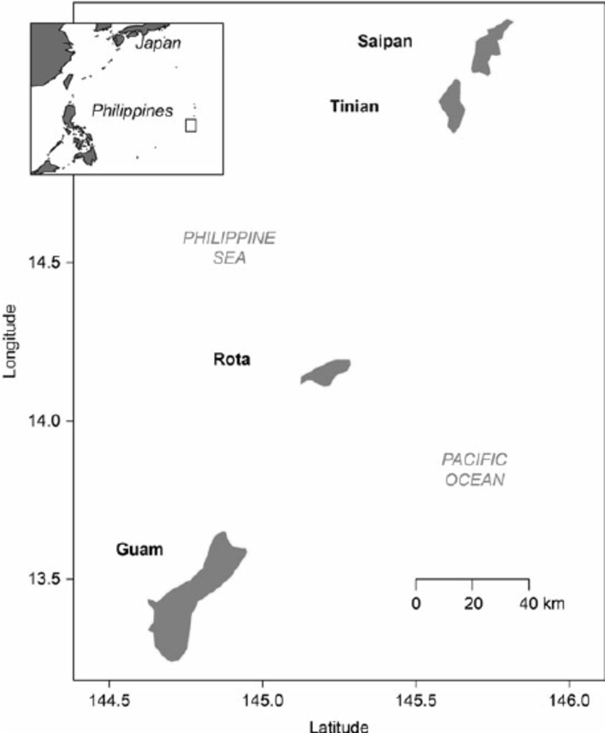
Guam is 145 latitude Saipan is 146 latitude